
Color scheme builder for Gvsig
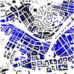
Here you can make color scheme files (.gvl) to be used with Gvsig (Gvsig is a software to manage geographical information licenced under Creative Commons Attribution-ShareAlike).These files will help you to format your vectorial data and, once saved as raster,be used inside the huellasolar system.Huellasolar works with raster where rgb values are the topographic elevation. Using the color scheme builded here you will format your vectorial data applying them the proper color scale in a easy an quick way.If your data are already raster there is also a tool that will help you to format them.Follow the link to the section Color table builder for Gvsig.You can check the video tutorial 'Formatting your data. Real case' where are explanations step by step.
 ►
►
The field of the table of data linked to your vectorial file containing the values of altitude
Type here the values of min and max heights for the color scheme. For example, if your projects are always under 500m of topographic elevation you can build a file with ranges between 0 and 500 that you can use in all your proyects.
Min Height
Max Height
Copy and paste the generated text with a text editor and change the extension to '.gvl'
